
![Rancho San Gerónimo [Revere] - Diseño #667 | ca. 1853](https://images.squarespace-cdn.com/content/v1/5cdf8d50c14cff00014b0f04/1585811426848-LCJXQLD4POV2B7PCHY9N/rg49ca-651+-+San+Gero%CC%81nimo+%28Revere%29%2C+Dise%CC%81nos+667%2C+Marin.jpg)
![Rancho San Gerónimo [Revere] - Diseño #667 | ca. 1853](https://images.squarespace-cdn.com/content/v1/5cdf8d50c14cff00014b0f04/1585811425010-6NPJQKPLQBGVYK2B2G1C/rg49ca-652+-+San+Gero%CC%81nimo+%28Revere%29%2C+Dise%CC%81nos+667%2C+Marin.jpg)
![Rancho San Gerónimo [Revere] - Diseño #667 | ca. 1853](https://images.squarespace-cdn.com/content/v1/5cdf8d50c14cff00014b0f04/1585811516290-O05JHZLGZGHM2QJVDN3A/San+Gero_nimo+%5BRevere%5D+Disen%CC%83o+667+GLO+No.+39+Marin+County+and.jpg)
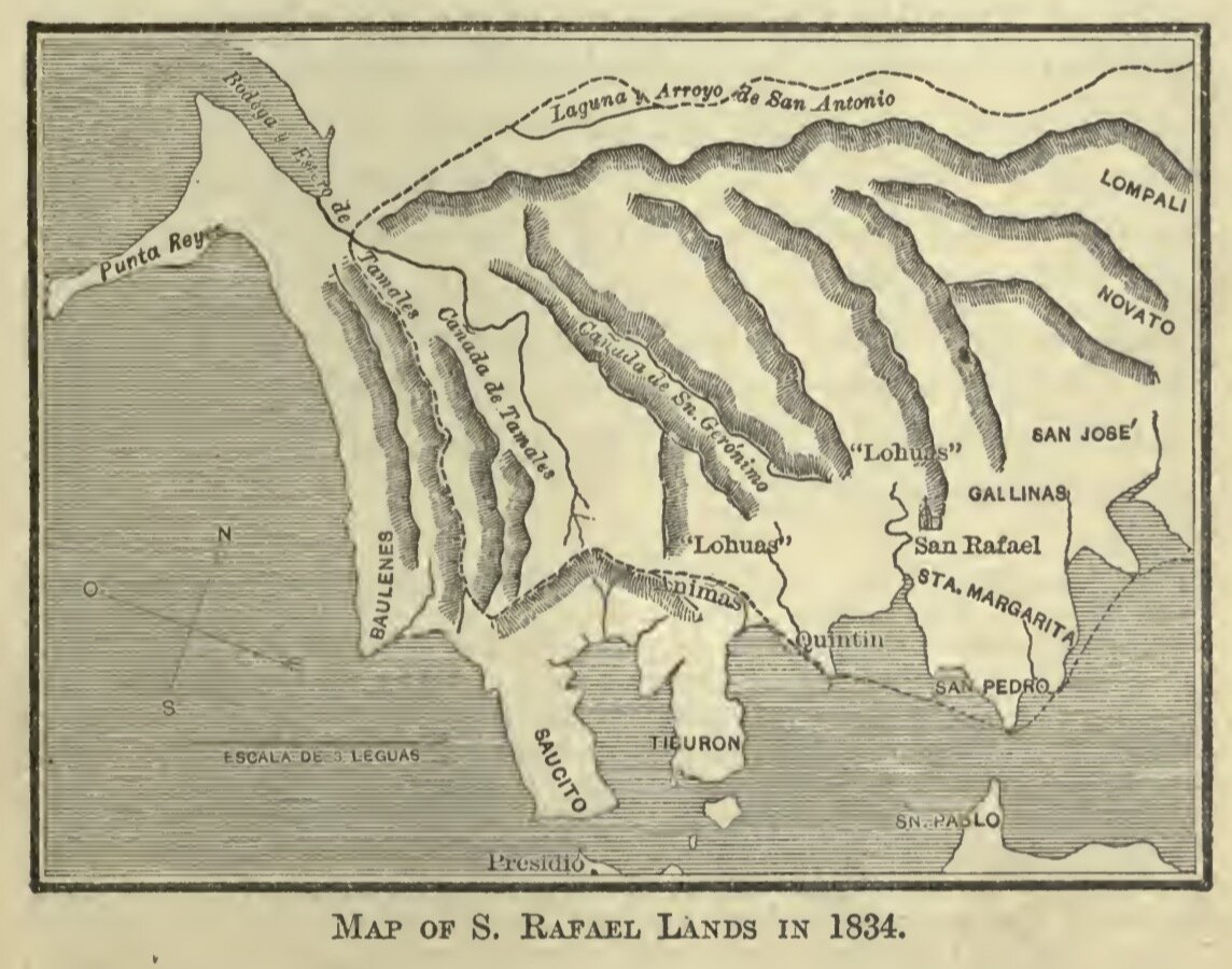
This map demonstrates the understanding that cartographers had of the Marin peninsula in the 1830s, as well as the extant of the lands under the influence of Mission San Rafael.
(The Works of Hubert Howe Bancroft. Volume XX. History of California. Vol. III. 1825-1840.)
(Courtesy California State Archives)
(A Tour of Duty in California by Joseph W. Revere)
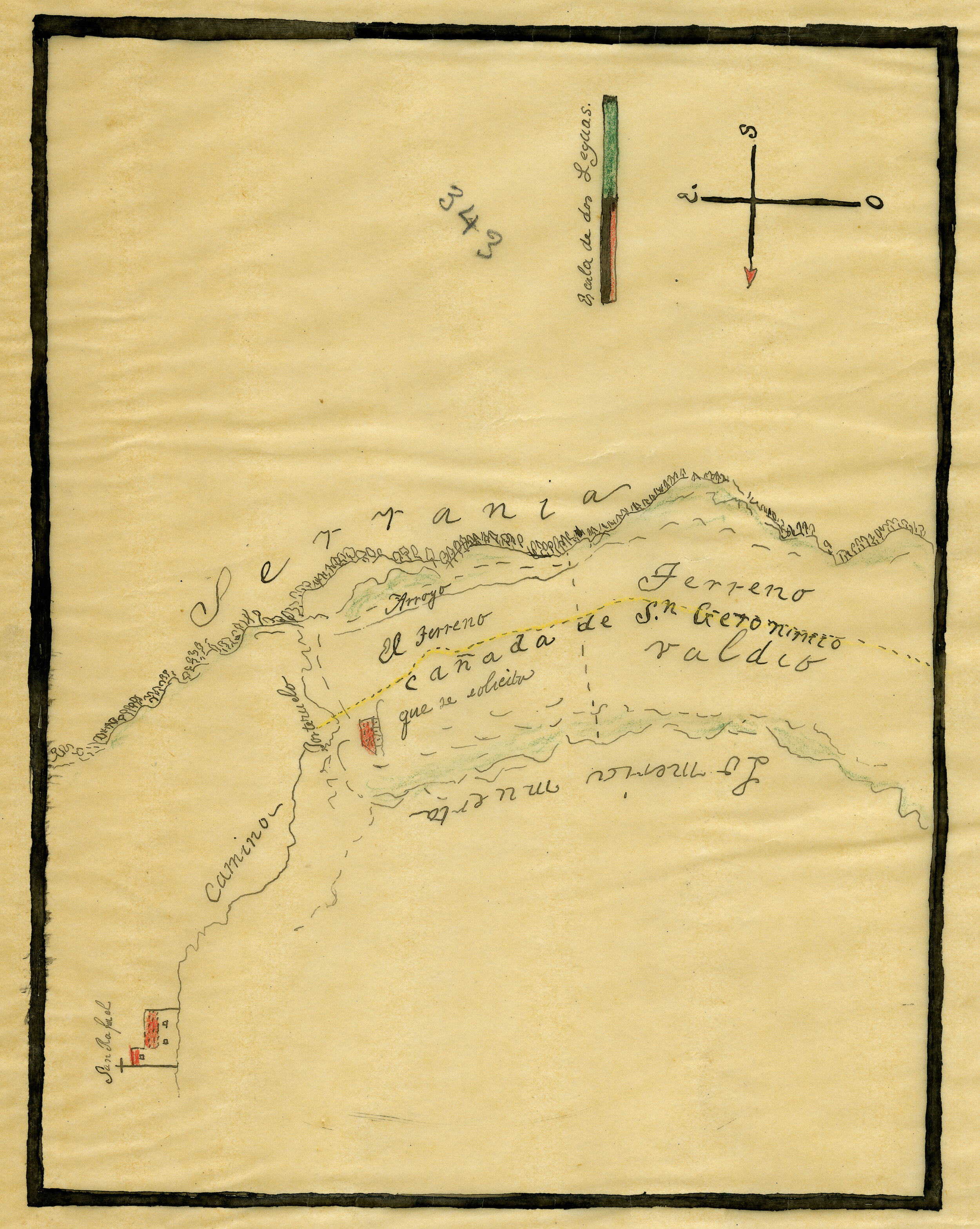
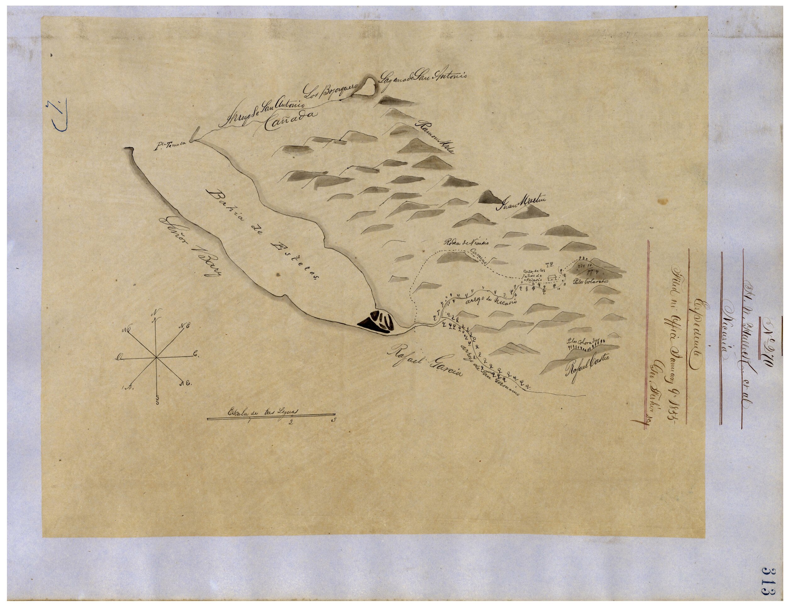
(Diseños – U. S. National Archives)
(Diseños - U.S. National Archives)
(Courtesy California State Archives)
(Courtesy California State Archives)
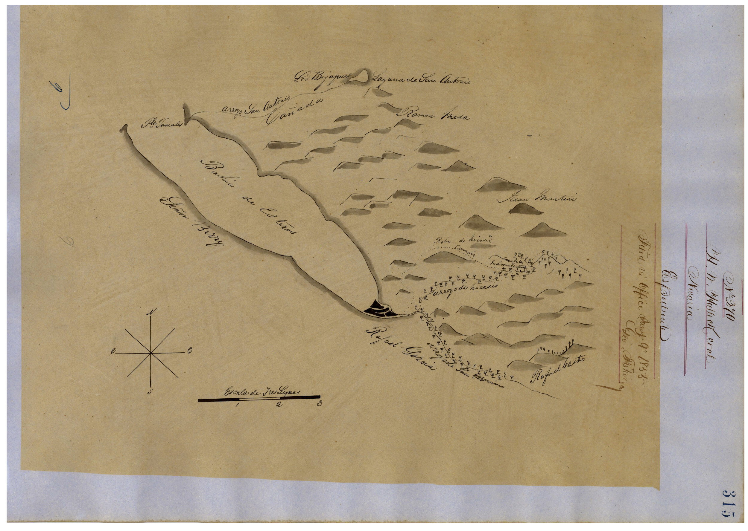
(Diseños - U.S. National Archive)
(Courtesy David Rumsey Map Collection, David Rumsey Map Center, Stanford Libraries)
(Courtesy David Rumsey Map Collection, David Rumsey Map Center, Stanford Libraries)
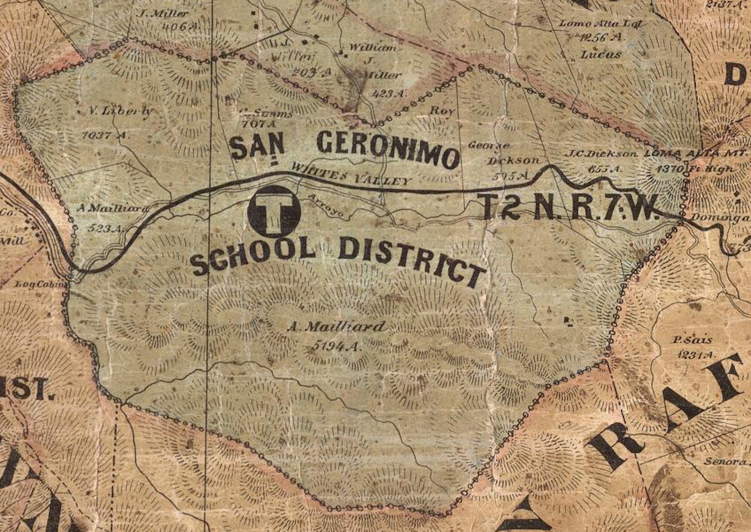
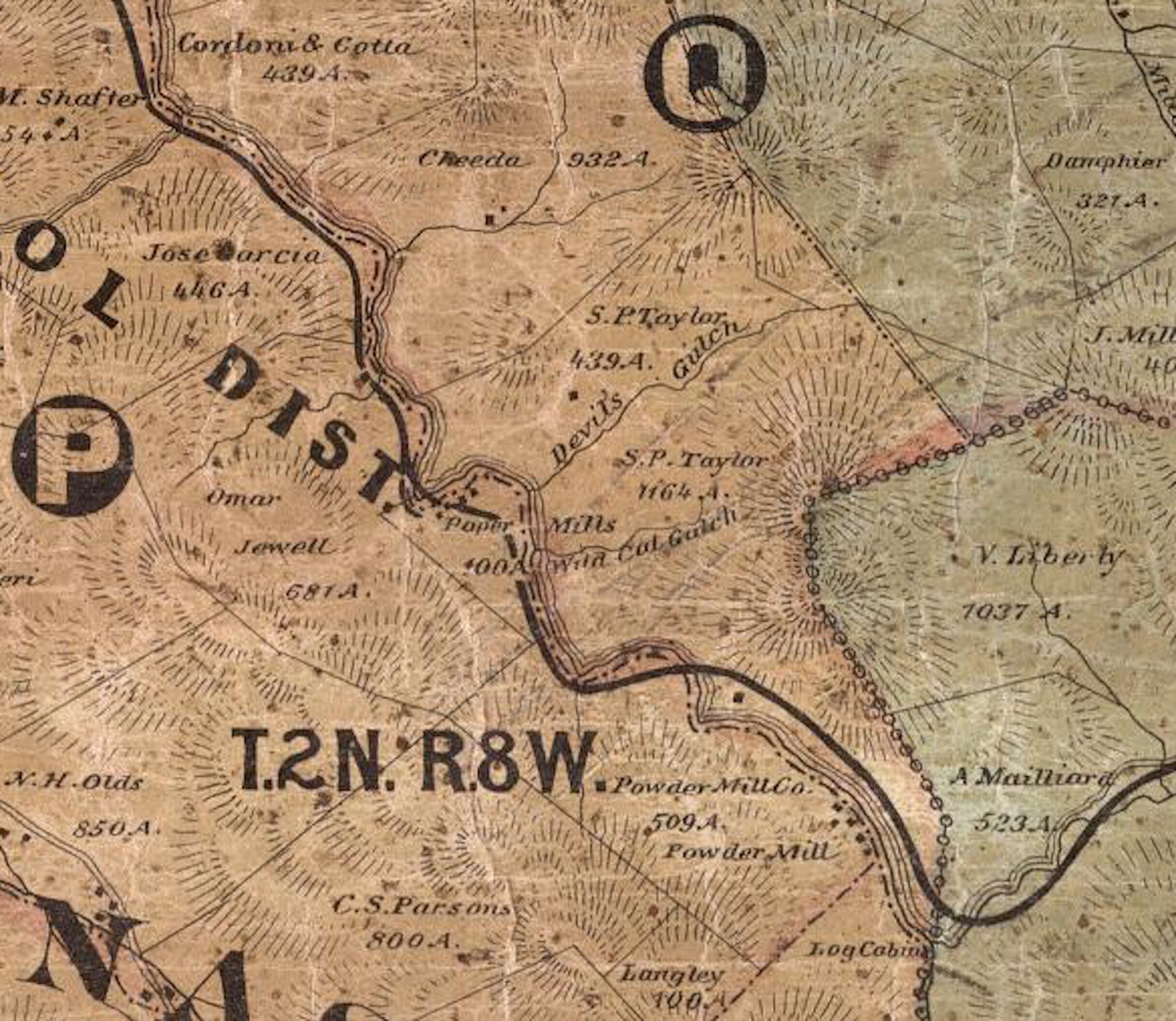
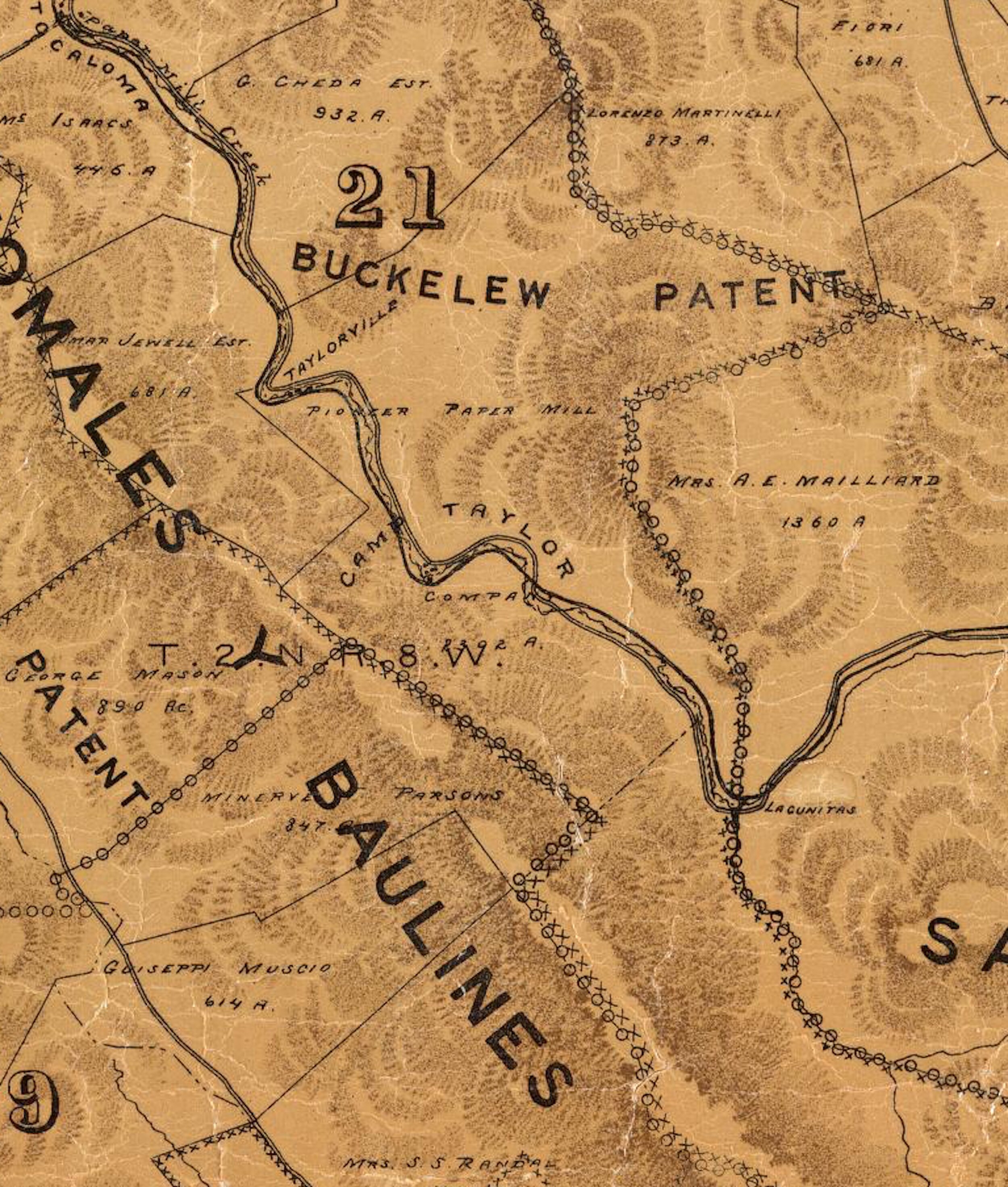
(Courtesy David Rumsey Map Collection, David Rumsey Map Center, Stanford Libraries)
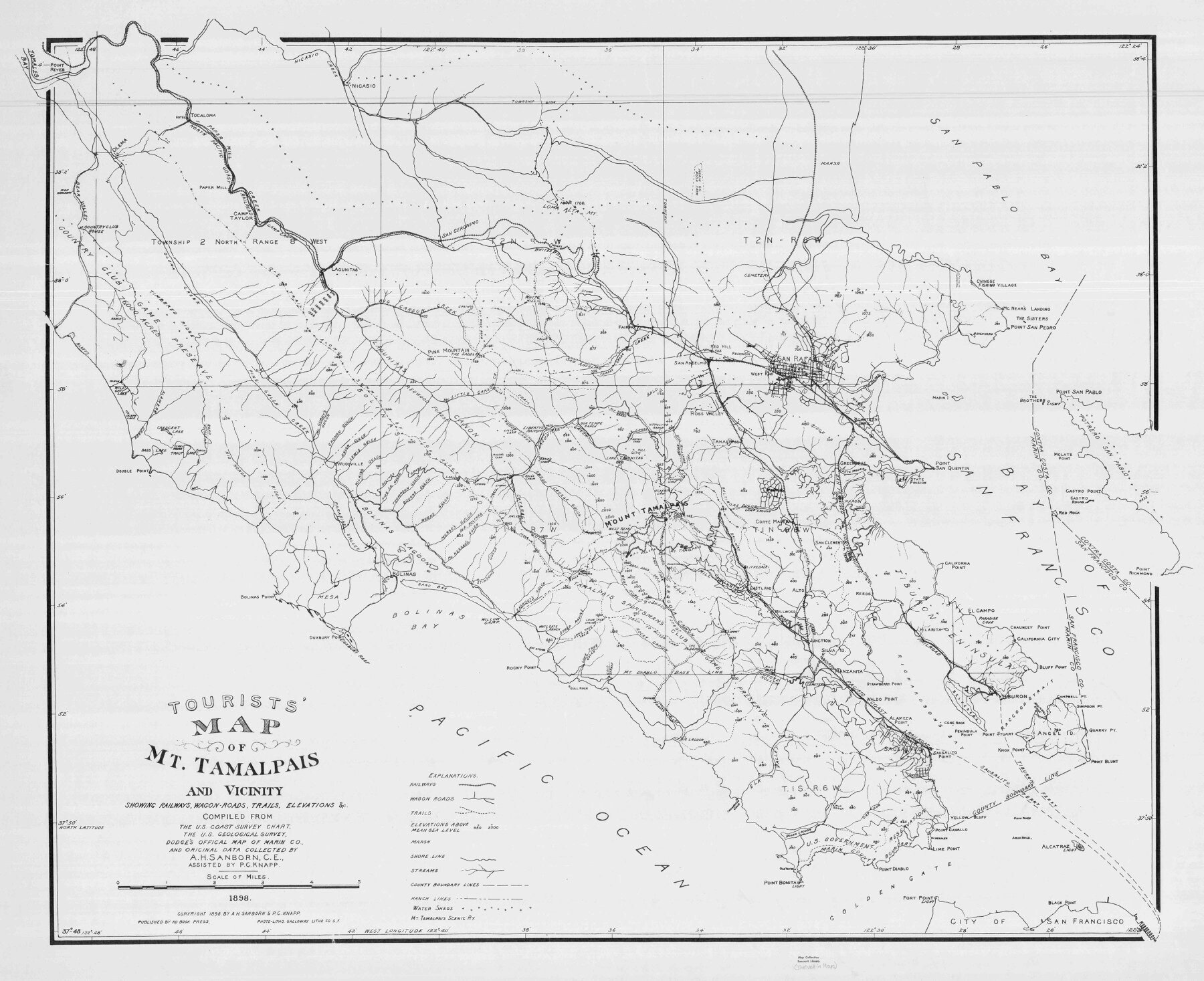
(Courtesy David Rumsey Map Collection, David Rumsey Map Center, Stanford Libraries)
Creek details in the pre-Kent Lake area include Big Carson and Little Carson.
(Courtesy Huntington Library.)
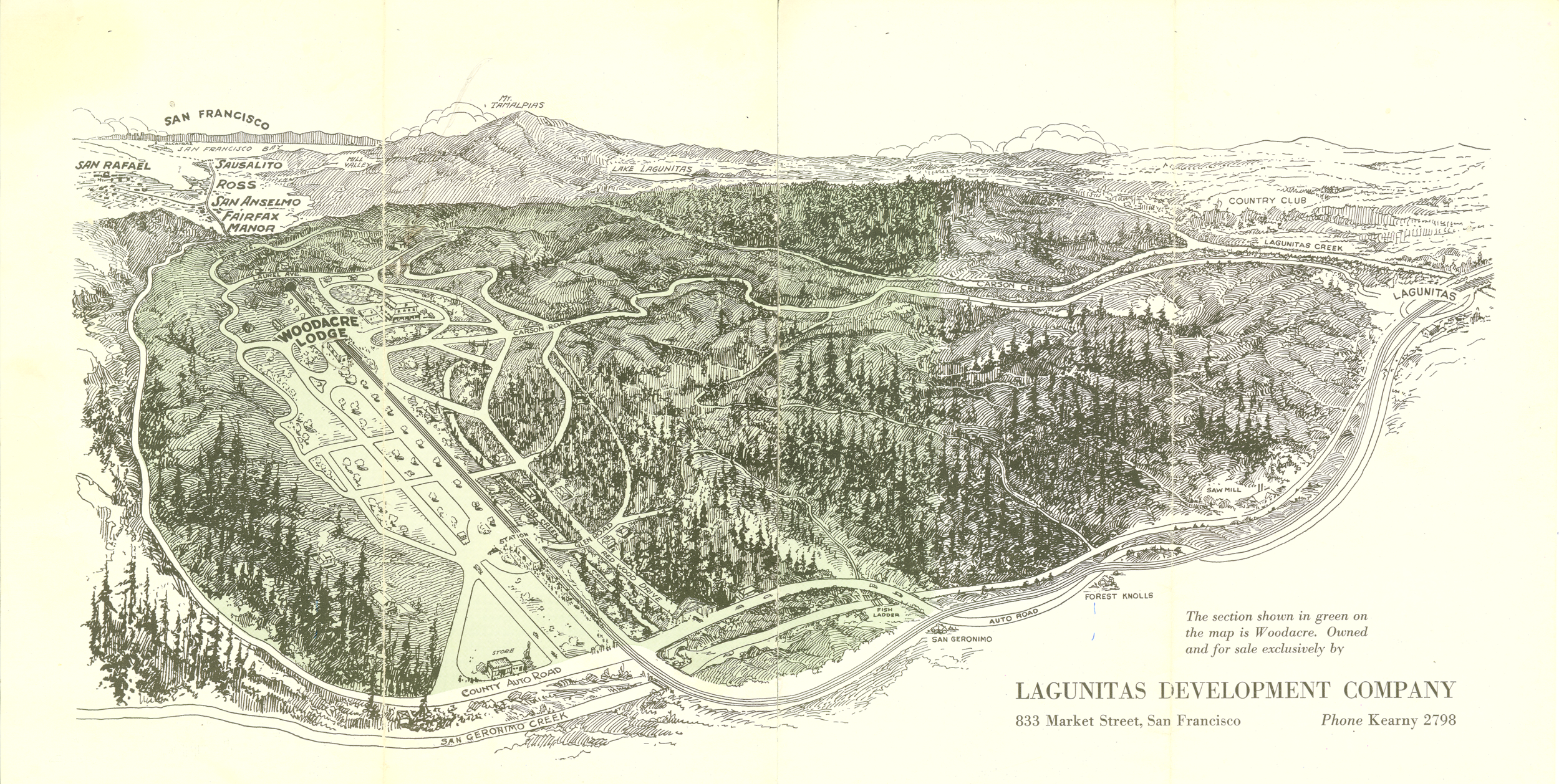
(San Geronimo Valley Historical Society Collection)
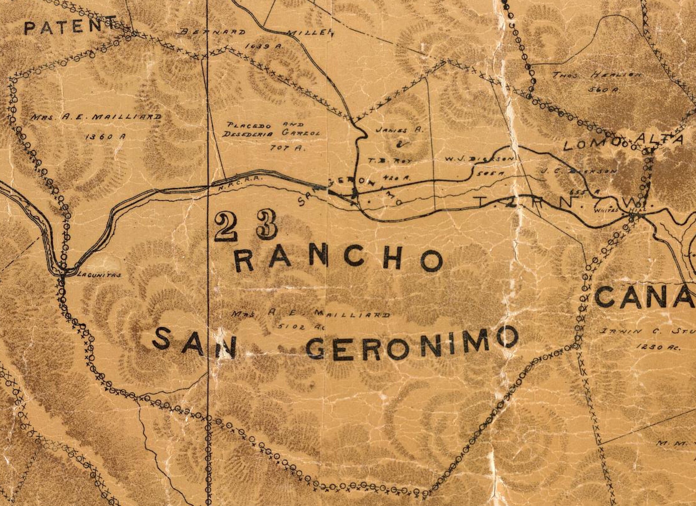
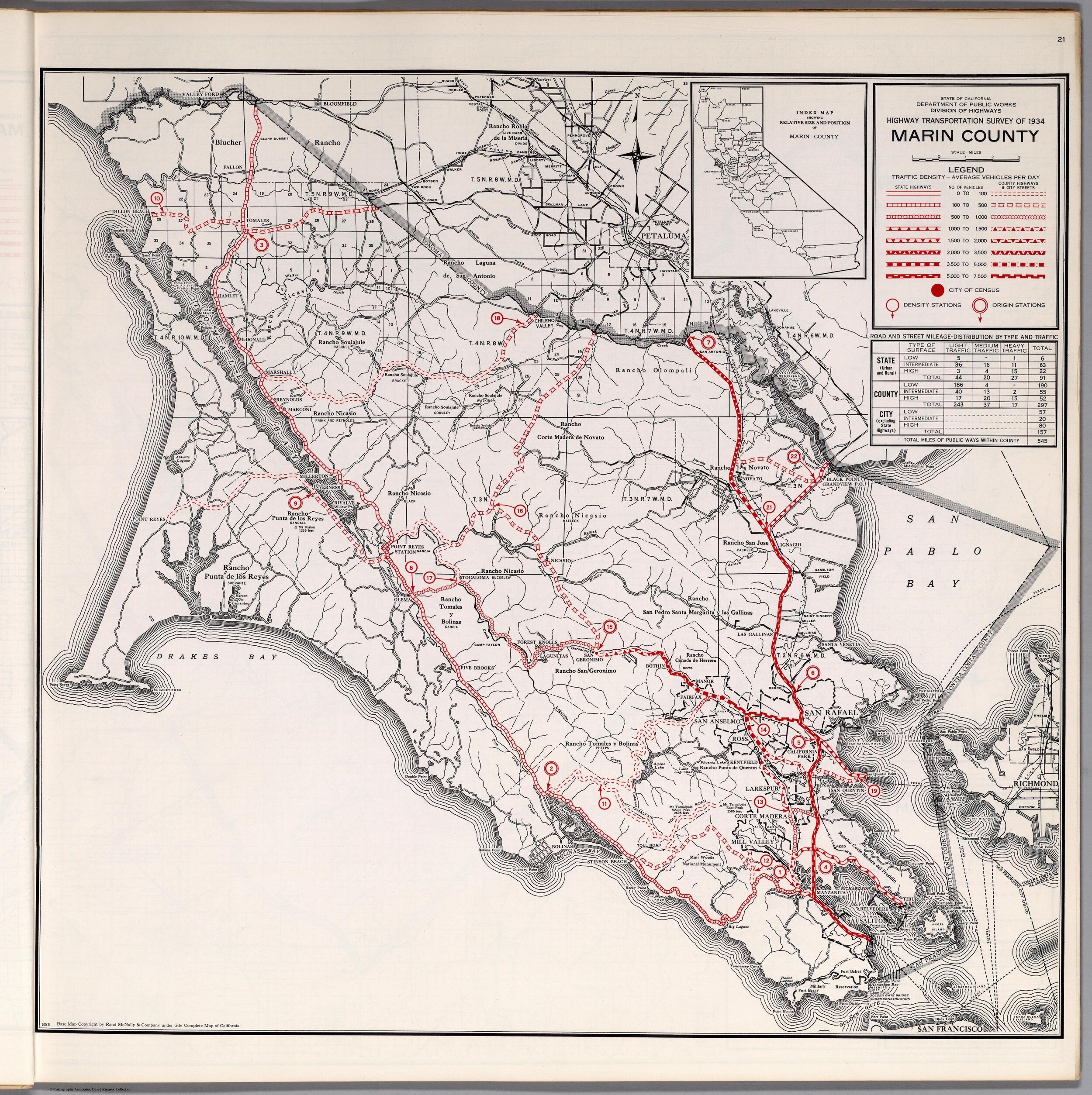
Map shows Sir Francis Drake Boulevard’s route before it was recut through the fields of the Ottolini and Roy ranches.
(Courtesy David Rumsey Map Collection.)